Where to go walking in Ireland is a question that many people ask when considering a visit to a country that still has a lot of wide-open spaces to explore.
 This post and page contain affiliate links and I may earn compensation when you click on the links at no additional cost to you.
Walking as an activity is more popular these days with the Irish themselves but it’s also intriguing to tourists looking to escape the hustle and bustle of their daily lives, to escape to a place that offers incredible scenery, and quite honestly, to get a more immersive experience while on vacation.
There are 44 National Waymarked Trails throughout Ireland, which were developed and are currently monitored by the National Waymarked Ways Advisory Committee of the Irish Sports Council.
They range in distance from 25 kilometers (about 15 miles) to 200 kilometers (approximately 124 miles).
Many of them take days to complete; others are shorter in length.
Some of the walks mentioned in this blog post may also be of interest to backpackers traveling in Ireland.
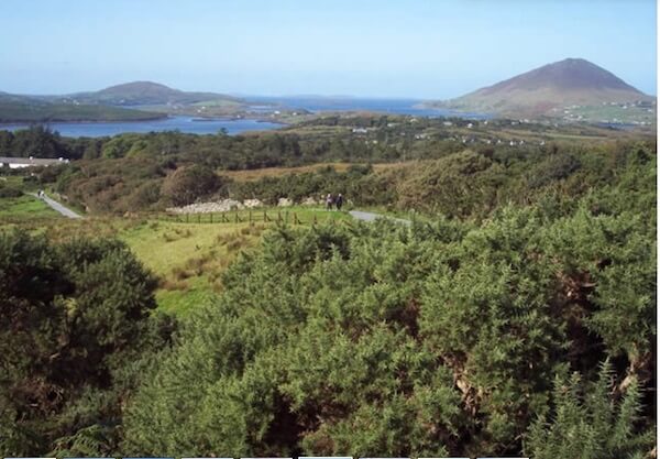
In recent years, over 150 looped walks have been developed nationwide that link to the larger Waymarked trails.
The shorter walks can take anywhere from an hour to a full day to complete.
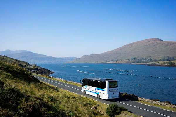
While it’s true that you can also explore Ireland by car and on a tour bus, seeing Ireland on foot is a totally different experience as these 10 different walks will show you.
All 10 walks included here are rated according to skill level, so pick one that’s best for you.
The best time to walk on such trails is in April through October, although walking any time of year in Ireland is doable.
Best of all, these walks are all free!

- Book the best tours and guides on Tripadvisor, Viator or GetYourGuide
- Get reliable travel insurance with Travel Insurance Master
- Get the best flight tickets with Aviasales
- Rent a comfortable car via Discovercars
- Find the best accommodation on Booking.com or BandBIreland
No. 1 Carrauntoohill Mountain, Co. Kerry
Grade: Difficult
If you’re planning on climbing Carrauntoohill in Co. Kerry, Ireland’s highest mountain, you should be in good physical shape to take it on.
Having said that, you’ll be rewarded richly when you finally get to the top.
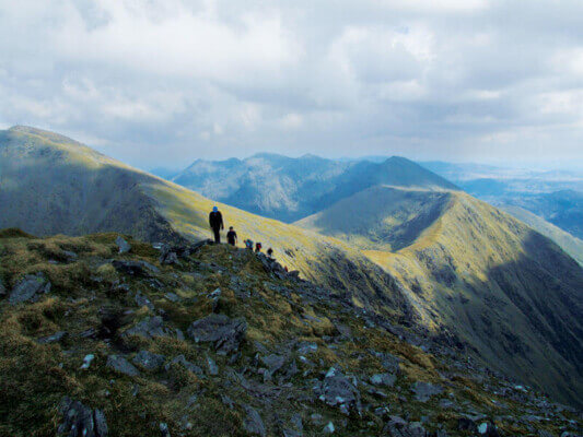
At close to 3,500 feet, Carrauntoohil is part of the MacGillycuddy Reeks range.
The Devil’s Ladder is the most popular route you can take.
Start at Cronin’s Yard, from where you will enter Hag’s Glen, giving you access to the beginning of the walk.
This 7-mile walk will take anywhere from 4 to 6 hours.
By clicking on the Amazon link below, I may earn a small commission from the Amazon Associates Program. However, you will not incur any additional costs by doing so.
Before attempting this hike, be sure to dress appropriately (in waterproof layers), wear good-quality, supportive hiking boots, a hat, and gloves in case it gets cold, as well as a map and even a compass.
If you’re interested in staying in the area, Cronin’s Yard camping pods are ideal.
Rent either a standard pod, suitable for up to three adults or a family pod, suitable for 5 adults or two adults and three children. Rates are around €15 per person.
No. 2 Cuilcagh Legnabrocky Trail, Co. Fermanagh
Grade: Difficult
Drive about 10 miles from Enniskillen and you’ll discover the beginning of the 4.6-mile/7.4 km Cuilcagh Legnabrocky Trail located on the border of Counties Cavan and Fermanagh (Northern Ireland) and within the Marble Arch Geopark.
This meandering path, part boardwalk, part gravel track and exposed mountain path, winds its way through the largest expanse of blanket bog in Ireland.
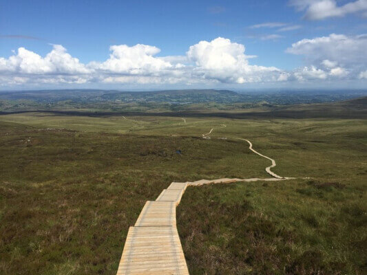
The boardwalk was installed in 2015 to preserve this rare bog from erosion caused naturally by walkers.
Expect this walk to take you about 6 hours.
Because much of it is quite isolated, be sure you are fit enough to take this on, bring enough food and water to sustain you along the journey, as well as a map.
An OSNI (Ordnance Survey of Northern Ireland) map is recommended and can be purchased online.
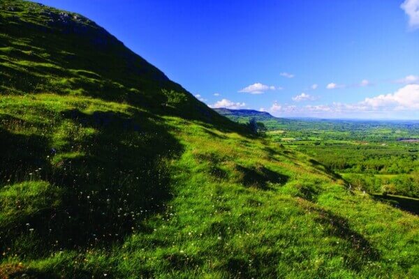
If you’re up for it, however, this popular trek is well worth the effort.
Once you make the final ascent to the top of Cuilcagh Mountain, the views are simply outstanding.
By clicking on the Amazon link below, I may earn a small commission from the Amazon Associates Program. However, you will not incur any additional costs by doing so.
The steps are steep, so be prepared. As with any long walk or hike, be sure to wear comfortable walking shoes and waterproof clothing as the weather can change suddenly.
No. 3 Croagh Patrick, Murrisk, Co. Mayo
Grade: Moderate to Difficult
If you haven’t heard about Croagh Patrick, Ireland’s holy mountain, here’s a quick history.
Ireland’s patron saint, St. Patrick, fasted for 40 days in 441 A.D. on top of the mountain, which is why there’s a church located there today.
The chapel was built in 1905 using local stone and cement and carried up the mountain with the help of a donkey.
Archaeological excavations in 1994 revealed, however, that there was a much earlier church on top of the mountain, built as far back as the 5th century.
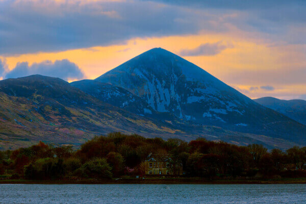
It’s a mountain that historically has been considered more of a pilgrimage site, with some people climbing to the summit on their bare feet!
On the last Sunday of July each year, over 25,000 people climb “The Reek,” as it is known.
By clicking on the Amazon link below, I may earn a small commission from the Amazon Associates Program. However, you will not incur any additional costs by doing so.
Climbing the 2,507-foot Croagh Patrick can be challenging for many.
There is a lot of stone and gravel on the path, so take your time and include plenty of breaks on your journey if you need them. If a walking stick helps, by all means, bring one.
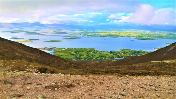
Once you get to the top, you’ll be rewarded with fabulous views of Clew Bay and the surrounding area.
No. 4 The Causeway Coast, Co. Antrim
Grade: Easy to Moderate
Officially referred to as the North Antrim Cliff Path, this pleasant close to 5-mile walk begins at the Giant’s Causeway and ends at Dunseverick Castle.
It is part of a larger trail that is called the Causeway Coast Way, a 33-mile walking route that goes from Portstewart to Ballycastle.
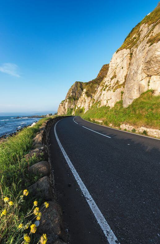
You can download the entire Causeway Coast Way walk here.
While the walk can be taken in either direction, many people start at the Giant’s Causeway.
You’ll take in some of the finest coastal scenery on the island of Ireland, with plenty of opportunities to spot the area’s rich birdlife, including nesting fulmars, jackdaws, and black guillemots.
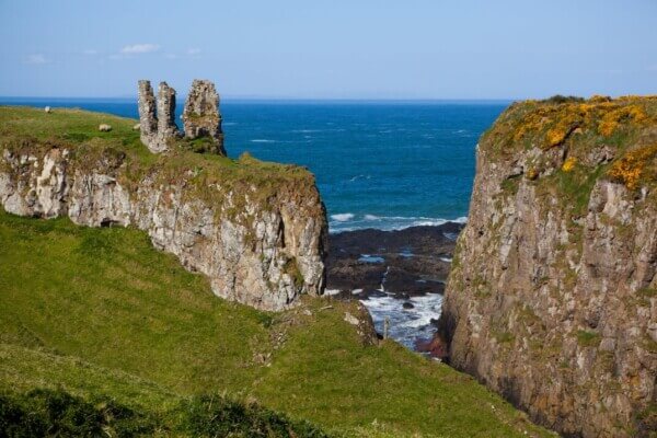
Other spots to look out for along the way include Port Moon, where a salmon fishery was once located, Portnabrock, Bengore Head, Benbane Head, Hamilton’s Seat, Plaiskin Head, and more.
While it may not be as well-known as Dunluce Castle, Dunseverick Castle sits on an equally dramatic landscape.
The castle was once the seat of Fergus the Great. In 1,000 A.D. it fell into the hands of the O’Cahan family, who lived there until about 1320, only to regain it in the mid-1600s.
It was destroyed by Cromwell and his troops in the 1650s.
Only the gate lodge remains today. Other parts of the castle fell into the sea during the 1970s.
No. 5 Benbulben Forest Park, Co. Sligo
Grade: Easy to Moderate
You will get pretty close to the summit of Benbulben, the iconic table mountain in County Sligo by taking this pleasant 7.2 km- walk (4.5 miles) that goes through a secluded forest before opening out to spectacular close-up views of it.
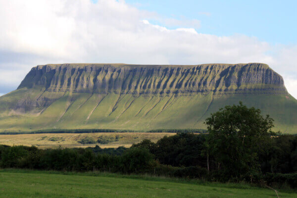
Benbulben, which is part of the Darty Mountain range, got its distinct shape during the Ice Age.
At the top of the mountain, there are a number of unique plants of Arctic origin that you won’t find anywhere else in Ireland, including the rare Tea Leaf Willow plant.
The end of the trail will take you up about 186 feet (60 meters), from where you’ll get panoramic views of Donegal Bay, Slieve League, the nearby fishing village of Mullaghmore, and Classiebawn Castle.
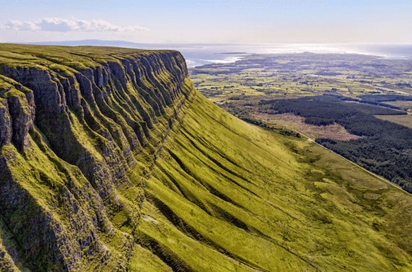
It takes about 1.5 hours to complete.
Be sure to wear sturdy walking boots, bring snacks, a mobile phone, and a map of the walk.
If you’re interested in climbing to the summit of Benbulben, High Hopes Walking provides an excellent guided tour that will take approximately 4 to 5 hours to complete.
The fee is €25 per person based on groups of 12. The walks are available year-round.
Read More: Four Walks in County Roscommon to Enjoy
No. 6 Glendalough – St. Kevin’s Way, the Pilgrim Path, Co. Wicklow
Grade: Moderate
This 18-mile trail follows the footsteps of St. Kevin, the founder of the Glendalough Monastic Site and of the pilgrims who visited the area after his death in 618 A.D.
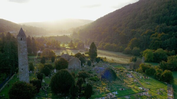
The flagstones of the original pilgrimage road can be seen along the popular trail.
Start your walk in Hollywood, a small village not far from the famous monastic site.
If you’re wondering, the town is connected to the more famous Hollywood in Southern California.
Matthew Guirke, a native of the Co. Wicklow Hollywood emigrated to California in 1840 and was the one who gave the ritzy neighborhood its name.
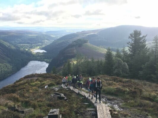
Climb toward the spectacular Wicklow Gap, the highest point on the route, and you’ll get awesome views of the lakes that form this region’s beautiful glacial valley.
The walk, which usually takes about a day to complete, ends at the monastic site.
Maps for the entire route can be found here.
No. 7 Mt. Errigal, Glenveigh National Park, Co. Donegal
Grade: Moderate
Mt. Errigal is the highest mountain in Co. Donegal and is part of the “Seven Sisters,” a mountain chain that is part of a larger mountain range called the Derryveagh Mountains.
The Seven Sisters include Errigal at 751 meters (2,463 feet); Mackoght (often referred to as “WeeErrigal); Aghla; Ardloughnabrackbaddy; Aghla Beg; Crocknalaragagh; and Muckish.
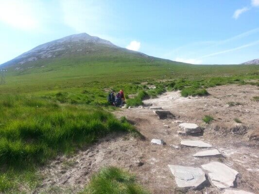
Errigal made it to National Geographic’s “2017 Cool List” in 2009 and was voted “Ireland’s Most Iconic Mountain” by Walking & Hiking Ireland. Perhaps that’s because of its ever-changing shape and pinkish glow.
Climbing Mt. Errigal is a challenging yet doable hike that will take you through a variety of terrain.
The route begins at the car park, which is just off the R251 from Gweedore to Letterkenny. There are no trail markers or defined paths at the beginning, however, so be careful where you step for the first half-hour or so.
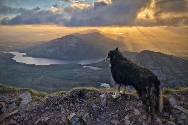
Once you get to the top, the views are stunning.
You’ll see vast moorland, the lakes that are part of Glenveigh National Park, the old ruined church in a valley known as the Poisoned Glen, as well as the magnificent Donegal coastline and the islands beyond.
The 6-kilometer walk (3.72 miles) should take you a couple of hours round-trip.
Be careful on the way down as it is easy to lose one’s footing on the small loose stones that cover the slope of the mountain.
No. 8 Cliff Path Loop, Howth, Co. Dublin
Grade: Easy
Dublin may be the urban capital of Ireland, but there are numerous opportunities for walking in the wide-open spaces, and they are only a half-hour from the city center.
If you’re in the mood for an invigorating walk along Dublin’s coast, then the Cliff Path Loop walk in Howth is for you.
To get there, hop on the northbound DART train at either Connolly Station, Tara Street Station, or Pearse Station.
The journey takes anywhere from 25 to 35 minutes.
A return ticket costs €6.25. You will save money on transportation around Dublin if you purchase the Leap Card.
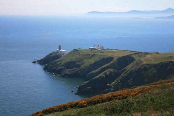
Once you get to Howth, you can begin the 6-kilometer (3.72-mile) walk from the station.
You have four loops to choose from. To begin any one of them just follow the green arrows that will guide you along the path.
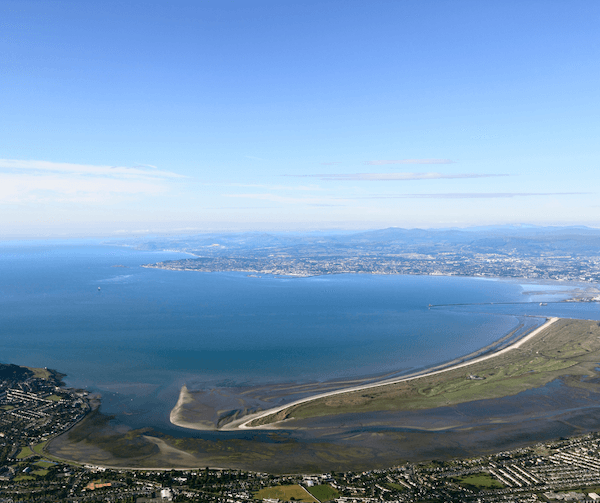
The path follows the coastline, offering breathtaking views of the cliffs and the islands known as Ireland’s Eye and Lambay Island.
You’ll also see the whole of Dublin Bay and the Wicklow Mountains in the distance.
Be sure to bring your camera along so you can also capture Bailey Lighthouse in the distance.

It was the last of Ireland’s lighthouses to become automated in 1996.
The round-trip journey can take anywhere from 90 minutes to 2.5 hours.
Check out this new coastal walking trail outside Dublin if you want to further explore the Dublin coastline.
Dublin Coastal Hike with Howth Adventures
No. 9 The Beara Way, Co. Cork
Grade: Moderate to Difficult
At 220 kilometers (approximately 136 miles), The Beara Way walk located on the Beara Peninsula consists of 15 looped routes.
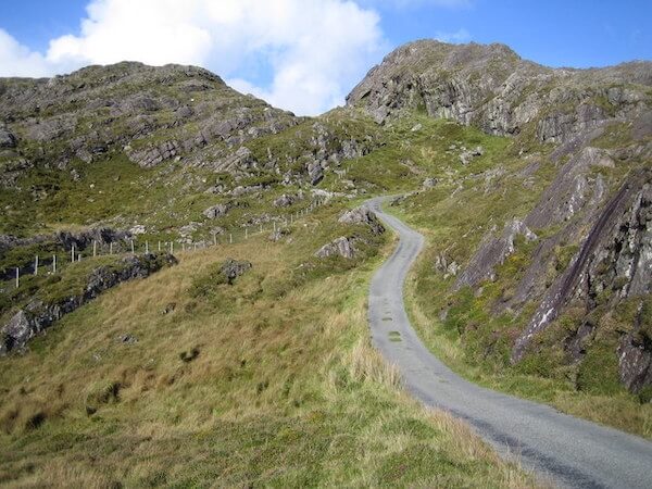
You can do the entire circular walk, which starts in Co. Cork and extends into neighboring Co. Kerry or you can choose one of the looped walks that will give you splendid views of mountains, lakes, and the ever-present Atlantic Ocean.
The trail, which was established by a local voluntary organization in the 1990s to generate more revenue for the area, crosses over some private land.
Because of that, dogs are not allowed.
It covers bog roads, woodland paths, and open moorland. Mobile coverage may be spotty in some areas, so be prepared.
The route is closed on Jan. 31st of each year.
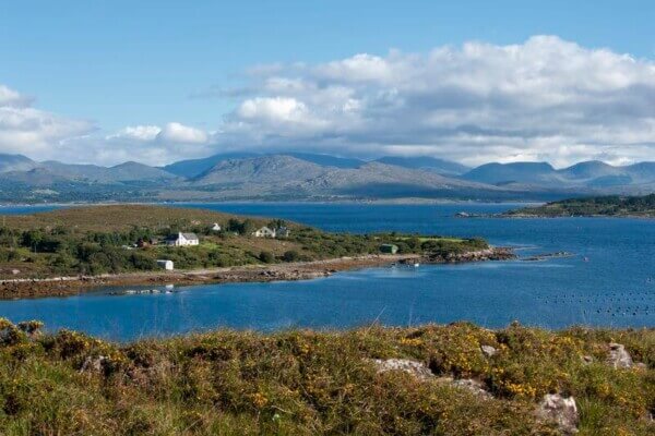
If you want to experience something different, consider the Allihies to Dursey Sound walk, a 4 to 5-hour trek that ends on Dursey Island.
As you make your way along the coastline, be sure to stop and take in the magnificent views of the Skellig and Scarrif islands. To get to the island, you’ll need to board the Dursey Island Cable Car.
Despite its remoteness, accommodation on the Beara Peninsula is plentiful.
Aer Lingus Vacation Store Special Offers
No. 10 Diamond Hill, Connemara National Park, Co. Galway
Grade: Moderate to Difficult
If you’ve always wanted to explore the wild and beautiful landscape of Connemara, then climbing Diamond Hill, an isolated peak near the village of Letterfrack, will give you a bird’s eye view of it all.
Diamond Hill is a small mountain compared with some of Ireland’s other peaks.
Located in Connemara National Park, it is popular for climbing.
In 2005, a wooden boardwalk and stone path trail was created to make it easier, as well as to alleviate the erosion that was taking place.
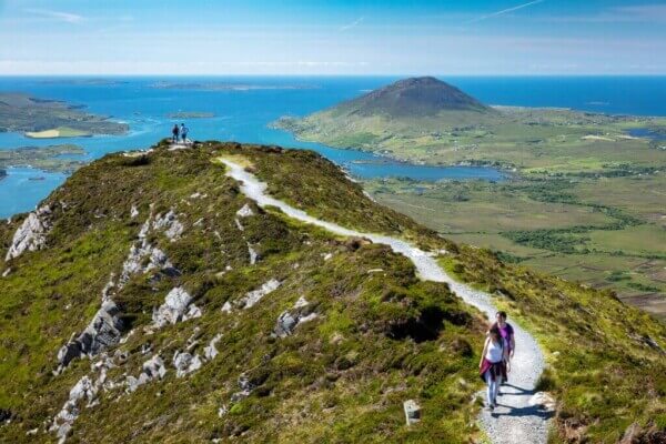
The most popular route for climbing Diamond Hill is the 2.5-hour round-trip trail that begins and ends at the National Park visitor center in Letterfrack.
As you make your way up the mountain, you’ll cross bog land before eventually reaching the mountain’s summit.
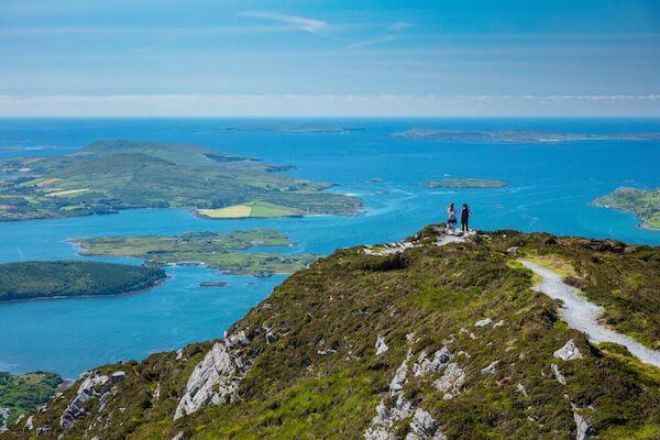
From the top, you’ll see the islands of Inishturk, Inishbofin, and Inishshark in the distance.
Turn to the north and you’ll catch a glimpse of Kylemore Abbey’s gothic turrets as well as Kylemore Lough and more.
Get Wifi in Ireland with Wifi Candy – save 10% with code IOB2024
Handy Resources Before You Go:
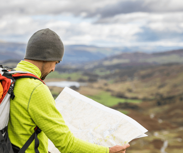
Maps — When walking in remote areas, it’s advisable to carry a map or download one on your smartphone. Ordnance Survey Ireland provides an array of maps to choose from, like this one here.
Weather Check – Met Eireann is Ireland’s national weather forecasting service. Download the app on the Apple Store or Google Play.
Walking Tour Companies – There are quite a few tour companies to choose from. Here are some that offer both guided and self-guided tours.
- Hillwalk Tours – self-guided tours start at €419/$452/£359/$613 CAD/$700 AUD per person. The cost includes accommodation, breakfast each day, a detailed itinerary and maps, baggage transfer, and more. The price of each tour will differ and is dependent on the length of the tour and whether it is self-guided or guided.
- Footfalls Walking Holidays – self-guided tours are priced differently depending on the length of the tour. The 4-Day Wicklow Way self-guided tour currently costs from €425/$458/£364/$622/$710 AUD. Includes en-suite accommodation, a
- Ireland Walk Hike Bike – the self-guided 5-day Kerry Way Hike is priced from €378/£324/$408/$553 CAD/$631 AUD. The price includes ensuite accommodation with breakfast, holiday specialists to handle the details of your trip, digital route notes and maps or GPS navigation, luggage transfers daily, and more.
- Walking Holiday Ireland – an 8-day walking holiday in the Cooley and Mourne Mountains is currently priced from €799/$862/£685/$1,170 CAD/$1,335. The price includes nightly accommodation, breakfasts, detailed maps, route information, and more.
Travel Insurance – most walking/hiking tour companies strongly advise that you take out travel insurance before you arrive in Ireland. Ireland on a Budget recommends Travel Master.
Have you taken any of the above walks or wondered about where to go walking in Ireland?

