Updated December 2024–Clare County Council is currently making improvements to parts of the Cliffs of Moher Coastal Walk, a 20-km (12-mile) trail that runs along the cliffs from Doolin to Liscannor, which offers incredible views of the ocean and surrounding area.
This news item and page contain affiliate links and I may earn compensation when you click on the links at no additional cost to you.
The work is being done for safety reasons and on the heels of recent tragedies at the popular attraction.
Visitors are asked to take note of the following closures:
- The Southern Section (Liscannor/Hags Head): Six kilometers from Liscannor is fully closed due to severe safety concerns.
- The Northern Section: The northern section (Doolin) is OPEN from Doolin to Surfers Path only. At this point, walkers are advised to turn back and remain on the walk back to Doolin.
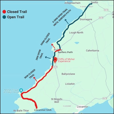
There is no access to the Cliffs of Moher Visitor Centre from Doolin. The Cliffs of Moher Trail is only open for 1 kilometer north of the visitor’s center.
Be sure to stay on designated paths at all times, do not go beyond walls or barriers, and avoid walking on the road at Surfers Path since it is hazardous.
Visitors can still access 800 meters of safe walkways and viewing platforms.
One of Ireland’s Most Popular Attractions
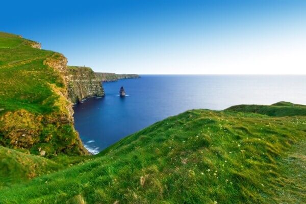
The Cliffs of Moher is among Ireland’s most popular visited attractions, with approximately 1.5 million people going there each year.
Located on the southwestern edge of the Burren, an area famous for its dramatic limestone landscape, the cliffs rise to approximately 702 feet (214 meters) at their highest point and continue for 8 km (5 miles) over the Atlantic Ocean.
The Cliffs of Moher are a Signature Discovery Point along Ireland’s Wild Atlantic Way
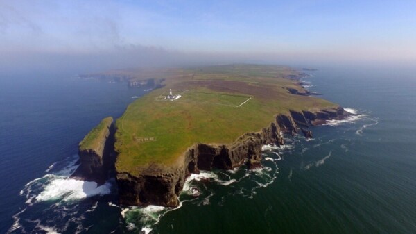
You can see the Aran Islands from there, as well as the Maumturks and Twelve Pins mountain ranges in County Galway, and Loop Head in Co. Clare to the south.
On a visit to the Cliffs of Moher, your first stop should be at the visitor center.
Constructed in 2007 into a nearby hillside, the Cliffs of Moher center includes a number of exhibitions that bring the story of the cliffs to life.
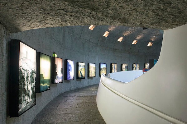
The interactive media displays cover the geology, history, as well as the flora and fauna of the cliffs.
A large multimedia screen shows a bird’s eye’s view of the cliffs and an underwater video shows the caves that lie several hundred feet below.

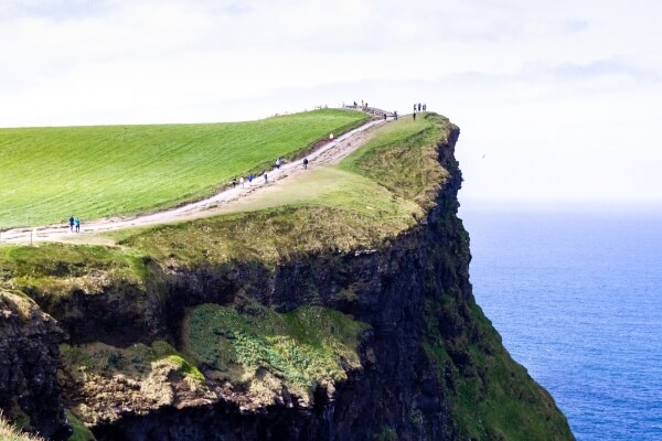
A popular landmark along the cliffs is O’Brien’s Tower, which marks their highest point.
The tower was built in 1835 by a local landlord and Member of Parliament Sir Cornelius O’Brien as an observation tower for English tourists visiting the area.
You can get a different perspective of the Cliffs of Moher by taking a cruise from nearby Doolin.

The hour-long excursion is available from mid-March through the end of October.
Audio commentary is offered in English, French, German, Spanish, and Italian.
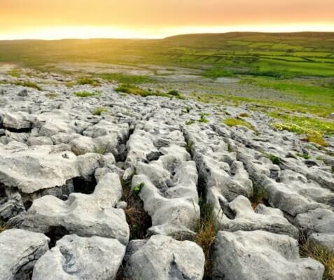
While you’re in the area, be sure to explore the Burren landscape, a UNESCO Global Geopark.
Save on Wifi in Ireland with WiFicandy – take 10% off with code IOB10
The limestone formations in this area of Co. Clare is in stark contrast to Ireland’s more familiar green fields, but no less beautiful and truly a sight to behold.
The Burren is actually part of the Burren National Park, one of six protected regions in Ireland.
Its limestone landscape was formed as sediments in a tropical sea that covered Ireland approximately 350 million years ago.
This is why you’ll see the remains of ancient inhabitants of that tropical sea, including corals, sea urchins, sea lilies, and ammonites.
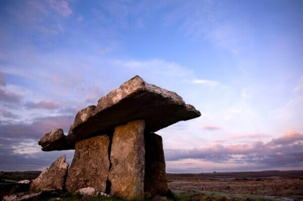
There are several ancient monuments to be found here as well, the most familiar and much-photographed one is the Poulnabrone Dolmen.
Free guided walks are available during the summer season.
The seven-way-marked walking trails in the park will give you a more concise view of the landscape.
The walks vary in length, from a 30-minute looped walk to a three-hour trek.

There is no visitor center in the park, although you will find information at the Burren Centre in Kilfenora.
The exhibits there are well worth checking out.
The Burren Tea Rooms and a craft shop are also on the premises.
If you’re visiting the Cliffs of Moher this year, be sure to book tickets online as the attraction can only accommodate a limited amount of people due to Covid-19 restrictions.
Read More: The Burren Experience, an Ireland on a Budget Tourism Ambassador