If the Cliffs of Moher is on your itinerary of places to go when you visit Ireland, you’ll be glad to know that there’s an app to help with that.
This news page contains affiliate links and I may earn compensation when you click on the links at no additional cost to you.

The app, which is available on Apple and Android devices, includes an audio-guided tour, with tracks from local guides as well as information about the cliffs, links to maps, and other information that is sure to make your trip to the County Clare and Wild Atlantic Way region a memorable one.
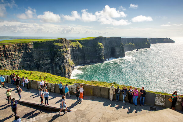
Free WiFi is available throughout the nearby visitor center building and viewing platforms, which will make it easier to access the app.
Radio presenter Conor Tallon narrates the Cliffs of Moher app’s 13 audio tracks, with additional contributions from people with knowledge of the rich history, geology, flora, and fauna of Ireland’s most popular and visited natural attraction.
You’ll also find tips on how to plan your visit to the Cliffs of Moher, when is the best time to visit, as well as information on other nearby places to explore.
About the Cliffs of Moher
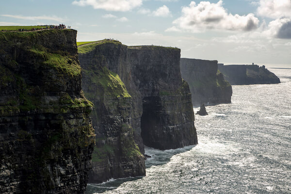
The cliffs, which gained UNESCO Global Geopark status in 2011, stretch for 5 miles (8 km) and reach 702 feet (214 meters) at their highest point.

O’Brien’s Tower is also a much-photographed attraction.
The tower was built in 1835 by local landlord and Member of Parliament Sir Cornelius O’Brien as an observation tower for English tourists visiting the area.
To view the cliffs, it is best to go directly to the visitor center where you can access 800 meters of safe walkways and viewing platforms.
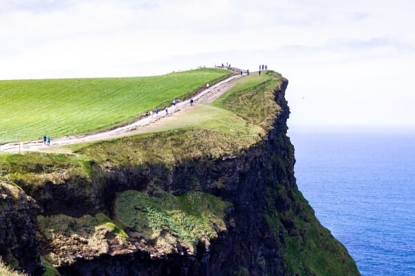
In August 2024, access to the popular Cliffs of Moher Coastal Walk was closed at certain points due to safety reasons.
Repairs to the trail, which connects the towns of Liscannor and Doolin, are ongoing and important, say Clare County Council, given the recent tragedies at the popular attraction.
What to Expect at the Cliffs of Moher Visitor Centre
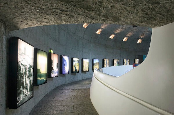
The visitor center includes exhibits that explore the different elements of the cliffs, including their connection to the ocean, nature, and humankind.
You’ll also find the Cliffs View Café there as well as the Puffins Nest Café and a Shannon Heritage craft and gift store.

If you want to get up close to them, you could take a cruise from Doolin, available from mid-March through the end of October.
Audio commentary is available in English, French, German, Spanish, and Italian.
Or, you could watch the virtual reality cliff-face adventure in the center’s theatre.
Other Attractions Nearby: The Burren
The surrounding County Clare landscape is also a place of great beauty and that is particularly evident in the Burren, a UNESCO Global Geopark that is part of the Burren National Park, one of six protected regions of Ireland.
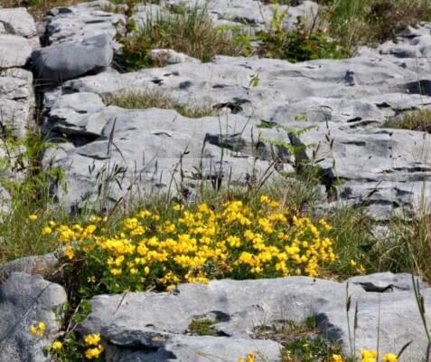
Its limestone landscape was formed as sediments in a tropical sea that covered Ireland approximately 350 million years ago, and the remains of corals, sea urchins, sea lilies, and ammonites can still be found there.
There are several ancient monuments to be found in the Burren.
The most familiar and much-photographed one is the Poulnabrone Dolmen.
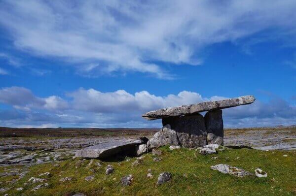
The large monument dates from the Neolithic Period (between 4,200 and 2,900 BC) and consists of three standing portal stones supporting a heavy horizontal capstone.
When the site was excavated in the 1980s, the remains of about 33 humans were found, along with various burial objects.
Free guided walks of the Burren are available during the summer season.