Updated October 2024–Ireland’s first official horse trail, located in the Beara Peninsula and known as the Beara Bridal Way, is the perfect place for riders who are eager to experience the beauty of this spectacular area of Ireland on horseback.
This news item and page contain affiliate links and I may earn compensation when you click on the links at no additional cost to you.
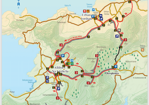
The horse trail, which was officially opened in 2023, can be found in West Cork along that county’s border with County Kerry.
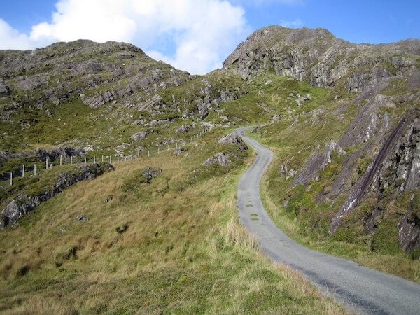
The trail takes riders through the Miskish Mountain range and some of the region’s most beautiful landscapes.
It also links the local villages of Allihies, Castletownbere, and Eyeries.
The project first began in 2016 on what was historically a horse trail that once facilitated the copper mining industry in nearby Allihies during the early 19th century.
Local authorities sought guidance from the British Horse Society given that there are no other official horse trails in the Republic of Ireland.
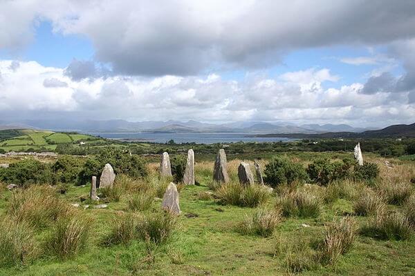
Along the 17-kilometer (10 miles) route, riders will discover plenty of evidence from Ireland’s ancient past, including Bronze Age wedge tombs, stone circles, and standing stones.

Visitors to the area who don’t have their own horse can turn to the Lios Lara Riding Stables in nearby Castletown-Bearhaven.
Full day treks are available, which consists of approximately 5 hours of riding time, including doing the full route of the Beara Bridle Path.
The cost is €175 per person for a full-day trek and €80 for a half-day trek.
The route is, however, geared toward experienced riders since there are some steep inclines along the way.
The History of the Beara Peninsula
The Beara Peninsula area was first invaded by the Vikings.
In the 17th century, it became a defensive front for the English army against a possible attack from the French.
Before the Great Famine, approximately 39,000 people lived on the peninsula.
It is now home to about 6,000 residents.
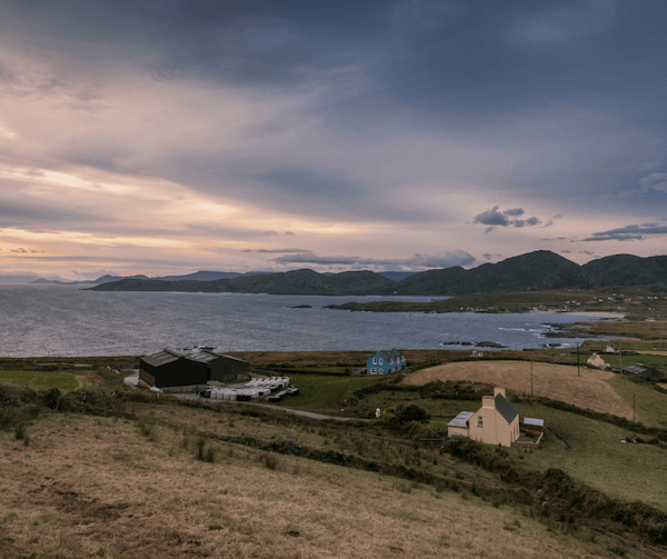
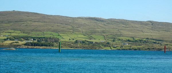
This region of West Cork is popular with tourists looking to escape to a place of both solitude and beauty.
It is also an ideal place to walk, cycle, or drive.
Find Accommodation on the Beara Peninsula
The Beara Way
The Beara Way is a 128-mile (about 220 km) distance trail that begins in Glengarriff and goes around the Beara Peninsula.
For serious walkers, this is a hugely rewarding hike that takes about 9 days to complete.
Feast your eyes on the rugged landscape and incredible beauty of the region in the video below.
Here are some notable landmarks along the Beara Peninsula’s Beara Way:
Carriganass Castle, a 16th-century tower house that once belonged to the powerful O’Sullivan Beare clan during the 16th and 17th centuries.
Kealkill Stone Circle, one of the most striking examples of megalithic architecture in Ireland.
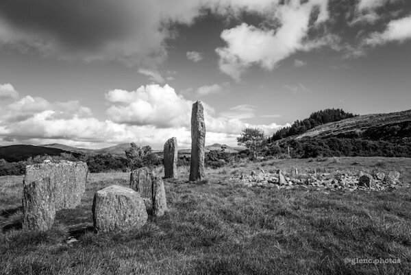
It consists of five axial stones with an additional two nearby. The tallest is over 4 meters (13 feet).
The Mass Rock, located on stage 3 of the route is a place where the Catholic mass was performed secretly during the Penal Times.
The Beara Peninsula was no different from other parts of Ireland where the practice of Catholicism was restricted and other constraints were put on the native Irish.
Bere Island, where you’ll find more ancient settlements such as ring forts, standing stones, and wedge tombs.
You’ll also discover the remains of four Martello towers built by the British following an attempted invasion by the French in 1798.
Dursey Cable Car, the only one of its kind in Ireland that will bring you to Dursey Island, an uninhabited island that is at the western tip of the Beara Peninsula.
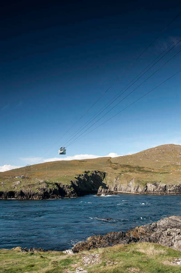
The island is 6.5 km long and 1.5 km wide (4 miles by 0.9 miles). It was originally made up of three villages. There are no shops, restaurants, or pubs on the island.
Tuosist, a mile outside the town of Kenmare in Co. Kerry, this area has an abundance of sea and mountain views, as well as lakes, semi-tropical gardens, woodlands, rivers, and waterfalls.
You must be an advanced rider to go on the Beara Bridal Way. For more information on booking, visit the website.
Read More: County Cork’s Spike Island Wins International Tourism Award