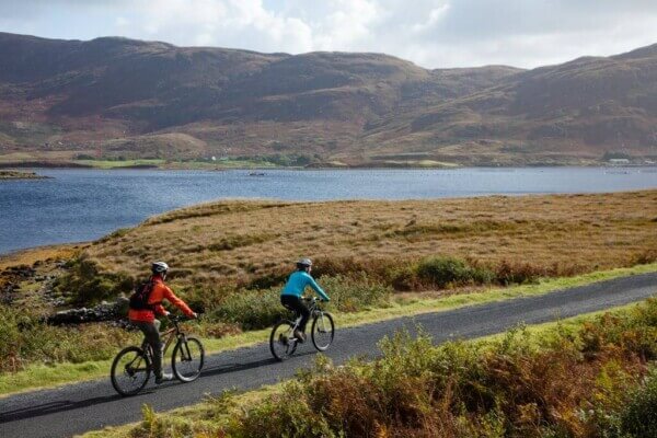
With an increased interest in walking and cycling throughout Ireland in recent years, it’s no surprise that Ireland’s greenways are being enhanced.
This news page contains affiliate links and I may earn compensation when you click on the links at no additional cost to you.
The Irish government recently announced a €63.5 million boost for several of them, many of which were once old railway lines.
Some of the greenways will become part of the European cycle route.
Here’s a look at the various greenways that walkers and cyclists can enjoy.
A few of them are new while others were created several years ago and are about to be extended with this latest funding.
COUNTY CORK
Midleton to Youghal Greenway
The 24-km (14 miles) greenway, to be constructed in this area of East Cork was once a former rail line that opened in 1860 and remained in operation until 1987.
The line was initially under the direction of Isaac Butt, an MP for Youghal, but little progress was made on it until a financier from London, David Leopold-Lewis, invested in the project.

His intention was to turn the seaside resort of Youghal into a “Brighton-by-the-Sea,” a reference to the popular town on England’s southern coast that benefitted greatly from the expansion of the railway.
The project is expected to be completed at the end of 2022.
Compare Cheap Flights with AirfareWatchDog! ![]()
Read More: 36 Hours in Cork City
COUNTY GALWAY
Connemara Greenway (Clifden to Recess & Galway to Moycullen)
The Connemara Greenway is a 76-km (48-mile) traffic-free cycling and walking route that begins in Galway city (at the Fisheries Field in NUI Galway) and ends in Clifden.
It follows the same route as the historic Galway to Clifden railway line that closed in 1935, taking in the towns of Moycullen, Oughterard, Maam Cross, Recess, and Ballynahinch.

The line was established in 1895. Prior to that, all supplies, including produce and cargo from Galway was delivered to Clifden by sea, a long and arduous journey.
As a result, the town of Clifden was isolated from Galway City and from the rest of the country.
After many years of operation, with the line losing money and in bad need of repair, the last train pulled out of Clifden Station on April 27, 1935.
Nothing really remains of the old track today, except for raised pathways that signify where the line once was.
The route, when fully complete, will cover some of the most beautiful landscapes in the West of Ireland. Updates on the progress of the Connemara Greenway can be found here.
Galway to Athlone Greenway
This greenway will complete the 270-km car-free trail that will be available for walkers and cyclists between Galway in the West of Ireland (Ballinasloe, to be exact) and the capital Dublin.
The new Ballinasloe to Athlone Greenway (about 5 hours in terms of walking) will join up with the existing Athlone to Dublin Greenway and Grand Canal cycle routes, providing much-needed tourism opportunities for East Galway.

This large-scale coast-to-coast operation is being managed by county councils in Galway, Roscommon, and Westmeath as these are the counties that the greenway will cut through.
Work began on the extension of the Grand Canal to Ballinasloe as early as 1824. This portion of the canal was 14 miles (22 km) long, 12 of which were bogland.
In fact, it was such an engineering challenge that engineers from around the world visited the area at the time to see how the project was coming along.
The canal at Ballinasloe opened to traffic on Sept. 29, 1828.
Read More: How to See Galway (Ireland’s Cultural Capital) in 36 Hours
COUNTY KERRY
Tralee to Fenit Greenway
This greenway is being built on top of the old Tralee to Fenit railway line, which opened to the public in 1887 with grand ambitions of capturing the Transatlantic trade. Unfortunately, this did not happen, and the line was closed to regular passenger traffic in 1935.
The 14-km (8 miles) line started at Casement Station in Tralee and ended at the pier in Fenit, where special trains could pull up alongside boats for the easy removal of goods.

The line remained open until 1978 during which time it was used for the transportation of goods as well as summer excursions.
The Fenit line also runs north of Tralee for about 3 km (1.86 miles) before heading west through rolling countryside and along the scenic Tralee Bay shoreline. The line also made its way north to Limerick, but that line was lifted in 1988.
It is expected to open in September 2022.
South Kerry Greenway
Once complete, this 32-km (19-mile) greenway will provide cyclists and walkers with an abundance of beautiful scenery.
Along the way, there will be much to see, including the Cahersiveen railway bridge, the Gleesk viaduct, and the Drung Hill Tunnels.

The greenway, which starts at Glenbeigh village and ends in Reenard, is being built on the old Great Southern Railway.
That line opened in 1893 and transported passengers from Killorglin to Cahersiveen.
A population decline and lack of industry forced its closure in 1960.
Construction is beginning during the fourth quarter of 2022.
Listowel to Tralee
This greenway, also in Co. Kerry is about to receive much-needed funds that will mean an extension of the Great Southern Trail walkway from Limerick, mentioned above, from the Kerry border to Listowel.
The greenway has been built along the old railway line from Newcastlewest to Abbeyfeale. The track closed over 50 years ago.
COUNTY KILDARE
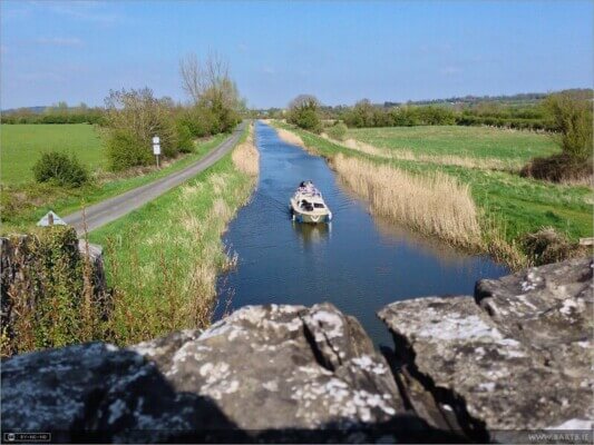
Grand Canal Aylmer Bridge to Sallins Greenway
Work on the Grand Canal at Aylmer Bridge to Sallins in Co. Kildare has also received the go-ahead.
This section of the canal is part of the Grand Canal Way, which is divided into nine sections across the middle of the country.

The Grand Canal is one of the two canals that originate in Dublin, the other being the Royal Canal. It eventually connects with the River Shannon in the west of the country.
The last working barge used on the canal was in 1960.
The idea of connecting Dublin with the Shannon River was proposed as early as 1715. By 1757, the Irish Parliament had given permission to start the project. The canal at Sallins was completed in 1779 and a twice-weekly service from the village to Dublin began in 1780.
The entire project took 47 years to complete.
Compare Car Rental Rates in Ireland
COUNTY LIMERICK
The Limerick Greenway
The Limerick Greenway was once a railway line that linked the city of Limerick with Tralee in North Kerry.
The line opened between 1867 and 1880 and closed between 1975 and 1977.
There are five sections to the greenway connecting the towns of Rathkeale, Newcastlewest, and Abbeyfeale on the Limerick/Kerry border.
The greenway reveals much of the beautiful Limerick landscape that is untouched by modern development, including sites like Doctor’s Bridge, constructed in 1880 that has a beautifully angled arch and stone walls, Tullig Wood, and the ruins of the 15th-century Lisnacullia Castle, among other interesting sites.
Work on this greenway is now complete and it was officially open to the public on July 1, 2021.
COUNTY LONGFORD
Canal Greenway
The County Longford section of the Royal Canal is also being upgraded.
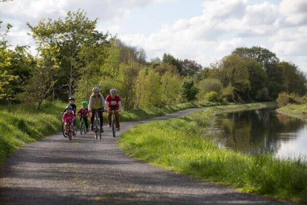
The 16-km greenway takes cyclists and walkers through some beautiful idyllic countryside, including nearby farmlands and bogland. The off-road trail connects Longford Town with the village of Clondra.

COUNTY MAYO
Great Western Greenway
The Great Western Greenway was the first greenway of its kind to be developed in Ireland and it is this plan that many other counties look to when expanding greenway opportunities in their communities.
It was built on top of the old Midlands Great Western Railway line, which closed in 1937.
The first 14 km (8.6 miles) of the 42-km greenway opened in 2010, with the remainder of it unveiled in June 2011.
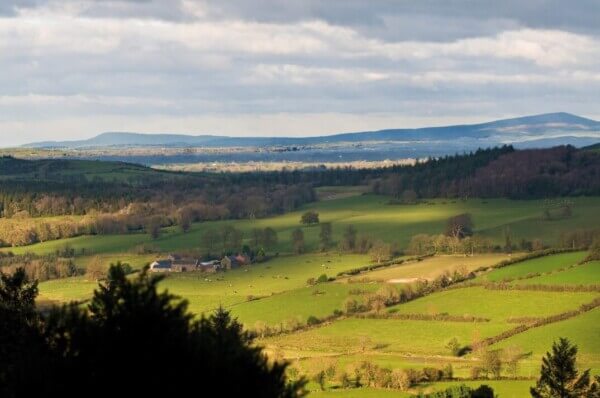
The part of the route that goes from Achill to Newport is particularly impressive, with walkers and cyclists getting the opportunity to enjoy the spectacular Nephin Beg mountain range that includes Nephin, its highest range, as well as the Nephin Beg, Slieve Carr, Birreencorragh, and the Corranbinnia/Cushcamcarragh mountains.
The greenway also takes in the area around Clew Bay and the nearby Croagh Patrick, Ireland’s holy mountain, in addition to the towns of Newport and Mulranny.
Read More: Ballina: Home of Joe Biden’s Ancestors
COUNTY OFFALY
Grand Canal Daingean to Lough Boora & Daingean to Edenderry
Two sections of the Grand Canal in Co. Offaly will be enhanced and ready for walkers and cyclists next year.
You’ll find two major tourist attractions near Lough Boora. They include the Tullamore Dew whiskey distillery and Lough Boora Discovery Park, which offers outdoor activities for all ages.
One of the hallmarks of the discovery park is the large-scale sculptures that are inspired by the nearby boglands and are now part of its permanent collection.
Other tourist attractions near both sections of this Grand Canal greenway include the 16th-century Ballycowan Castle, the Rahan Monastic Site, and Charleville Castle, a Gothic-revival building that is said to be haunted.
COUNTY WEXFORD
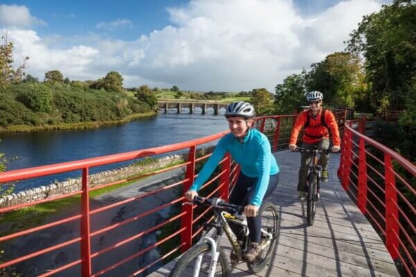
Waterford to New Ross Greenway
This 24-km (14.9-mile) cycling and walking route will link Ferrybank, Co. Waterford with New Ross in Co. Wexford, traversing parts of South Kilkenny and ultimately incorporating the Kilkenny Greenway.
The greenway is being constructed along the former railway line that ran between Waterford City and New Ross.
The railway line hasn’t been used since 1963.
Some of the more fascinating aspects of the new greenway will be the refurbishment of the Mount Elliot Bridge and Tunnel, which are both a part of the abandoned line. The Ballyvoyle Tunnel is also an iconic feature of the greenway.
Wicklow, Powerscourt and Glendalough Tour from Dublin
COUNTY WICKLOW
Blessington Loop Greenway
The Blessington Loop is a greenway that links the historic town of Blessington with the Palladian mansion at Russborough House in County Wicklow.
Walkers and cyclists can enjoy the beautiful scenery of the Blessington Lakes, as well as plentiful forest and natural woodland on this beautiful 5.5-km (3-mile) greenway.